Product Description:
Precision, velocity and balance are key to any moving object. When it comes to complex vehicles, like airplanes, autonomous vehicles, ships, spacecraft, submarines and even unmanned aerial vehicles (UAVs), the need for an accurate system that helps maintain and control perfect movement is essential. With the help of inertial navigation systems, moving vehicles can accomplish their tasks safely and precisely without using GPS.
The KsINS-01 integrated communication and guidance cooperative navigation system has been developed with a focus on UAV swarm formation flight. It seamlessly combines satellite navigation and data links to offer precise spatio-temporal references for UAVs. The system incorporates Beidou third-generation B1 and B3 frequency signal reception, enabling inter-node networking communication and high-precision space-time synchronization capabilities. Achieving a spatio-temporal synchronization accuracy of better than 0.1m/1ns under satellite effective conditions, and 5m/5ns under satellite rejection conditions.

Features:
● High-precision spatio-temporal synchronization between nodes based on carrier difference
● High-precision spatio-temporal synchronization between nodes under satellite rejection conditions
● In-depth integrated design of satellite navigation and data link
● Highly reliable networking and data transmission between nodes
Technical Parameters:
Performance indicators :
| Satellite positioning accuracy (2σ) |
Level: 6m, elevation: 8m |
| Data link working frequency band |
3.4GHz~3.6GHz |
| Frequency hopping rate |
80000 hops/s |
| Communication distance |
100km |
| Communication rate |
200kbps |
| Number of supported nodes |
64 |
|
Spatiotemporal synchronization accuracy when satellites are available
(RMS)
|
0.1m/1ns |
|
Spatiotemporal synchronization accuracy in case of satellite rejection
(RMS)
|
5m/5ns |
Application environment :
| Working/storage temperature(℃) |
-55℃ ~+70℃ |
| Dynamic Range |
Speed: -2000m/s ~ 2000m/s;
Acceleration: -30g ~ 30g; acceleration: -5g/s ~ 5g/s.
|
| Mechanical properties |
Endurance shock environment: half sine wave 20g, 11ms
Endurance vibration environment: typical drone vibration environment
|
Physical properties:
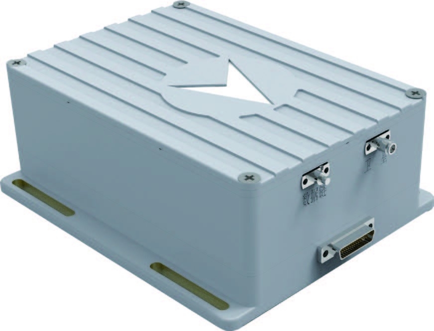
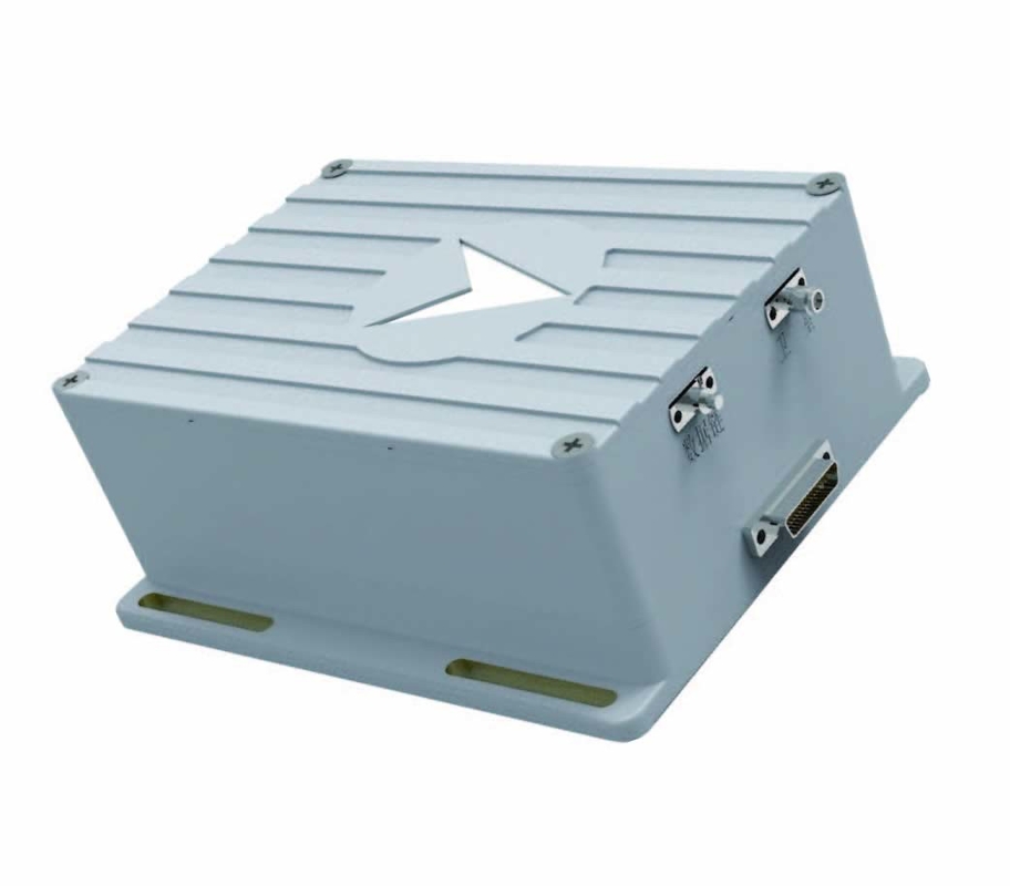
| Dimensions |
160mm x 150mm x 56mm |
| Installation dimensions |
160mm x 150mm |
| weight |
Host ≤ 12.5kg |
External Interface:
| Power Requirement |
18V~36V DC, power consumption ≤ 30W, allowed power interruption is no more than 5ms |
| Input/output interface |
2 RS-422, 1 RS-232, 1 100M Ethernet |
| Data output frequency |
10Hz (typical) |
Support and Services:
- We offer a variety of resources to help you get the most out of your electronic gyroscope sensor.
- We provide 24/7 customer support to answer any questions or concerns you might have.
- Our team of engineers is available to provide technical advice and trouble assistance.
- We provide a warranty for all of our products to ensure that you are satisfied with your purchase.
Packing and Shipping:
The INS is packaged in a cardboard box with foam padding to protect the product during transit. The box is labelled with the product name and the customer's shipping address. The box is then sealed with packing tape and shipped to the customer via a reputable third-party shipping provider.

 پیام شما باید بین 20 تا 3000 کاراکتر باشد!
 english
 français
 Deutsch
 Italiano
 Русский
 Español
 português
 Nederlandse
 ελληνικά
 日本語
日本語
 한국
한국
 العربية
 हिन्दी
 Türkçe
 indonesia
 tiếng Việt
 ไทย
ไทย
 বাংলা
বাংলা
 فارسی
فارسی
 polski